

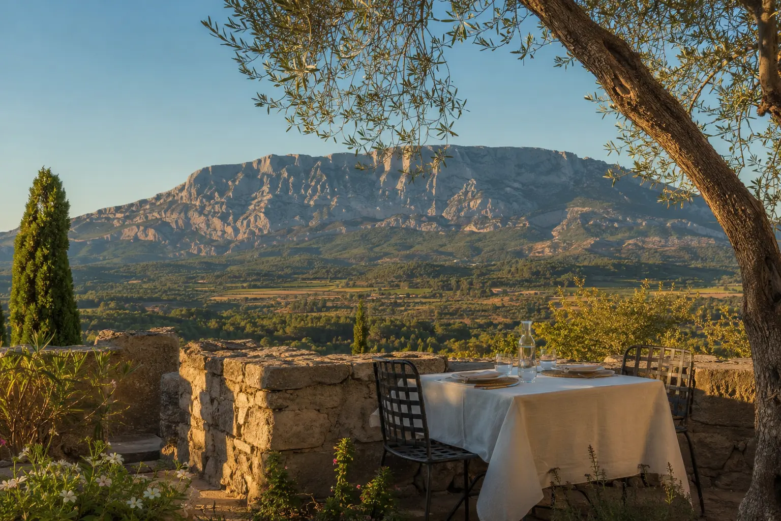
Original BestAix visual · illustrative, not documentary evidence
The Cézanne landscape
Sainte-Victoire,
at the right level
A viewpoint, a gentle walk and a summit hike are three different days.
The shortlist in brief
The mountain requires a specific plan
“Visit Sainte-Victoire” is not an itinerary until the approach, route and return are named.
Select a viewpoint or trail suited to the group, carry sufficient water and use official fire-risk access information. A qualified local guide is valuable for route choice, geology, Cézanne context and changing conditions.
- Start with
- Terrain des Peintres
- Why it leads
- Level 1 · View from Aix
- Verify first
- Go in clear, cooler light and respect the residential setting.
Meet the mountain
Five levels of Sainte-Victoire experience
The mountain is not one viewpoint or one hike. Choose the level that fits fitness, heat, transport and interest.
Terrain des Peintres
- Above Atelier Cézanne
- Sainte-Victoire views
- Free outdoor stop
The simplest place to connect Cézanne’s repeated view of Sainte-Victoire with the present landscape, without committing to a mountain excursion.
BestAix noteGo in clear, cooler light and respect the residential setting.
Le Tholonet and Route Cézanne
- East of Aix
- Landscape and heritage
- Best with car or guide
The closest transition from urban Aix into Cézanne country, with mountain approaches, stone, water and changing views.
BestAix noteDo not stop dangerously for photographs; use designated parking or a guide who knows the route.
Bimont dam and viewpoints
- Sainte-Victoire side
- Landscape walk
- Car or guided transport
Our accessible landscape choice for broad mountain views and a walk that can be adjusted to available time and conditions.
BestAix noteCheck parking, heat, wind and natural-area access before leaving Aix.
Bibémus quarries
- Cézanne geology
- Guided access
- Advance booking
A strong interpretive choice when stone, quarry landscape and Cézanne’s motifs matter more than reaching a summit.
BestAix noteUse the official guided format; access and parking are regulated.
Croix de Provence routes
- Exposed terrain
- Fitness and navigation
- Weather dependent
Only for properly equipped walkers who select a route matching current conditions and experience.
BestAix noteUse official route and access information or a qualified guide; turn back early when needed.
Natural-area access can close because of fire risk, weather or works. Use official conditions on the day and never treat an editorial route as a safety clearance.
- 5 considered choices
- Launch edition 23 July 2026
- By BestAix Editorial Team
- No paid rank
 01
01Choose the encounter
View, walk or hike
Ambition should follow conditions, not photographs.
A scenic drive or viewpoint works for limited time or mobility. A low-level walk near Le Tholonet adds texture and Cézanne context. Longer routes require footwear, navigation, water and an honest assessment of heat and exposure.
Do not use summit achievement as the only measure of value. The mountain’s structure is visible from below.
- First visit
- A guided contextual walk or carefully chosen viewpoint.
- Experienced hikers
- A named route with official access and weather checked.
 02
02Conditions decide
Heat, wind and summer access
The legal and physical conditions can change daily.
High temperatures, mistral and fire risk can close or restrict access to forest massifs. Consult the competent official information on the day, even when a booking was made earlier.
Start early in warm weather and carry more water than a city walk would suggest. Shade is limited on many routes.
- Day-before check
- Forecast, wind, guide message and transport.
- Day-of check
- Official massif access status.
 03
03Use expertise
A guide can change what you see
The best guiding combines safety and meaning.
Choose a qualified walking professional for demanding routes and ask about group size, insurance, language and alternative plans. A cultural guide may suit a gentle Cézanne landscape visit but not a technical hike.
Arrange the return before departure. Sunset experiences require particularly clear vehicle and torch planning.
- For hiking
- Route competence, safety and current-condition judgment.
- For Cézanne
- Art-historical context connected to real viewpoints.
Before deciding
The checks behind a good shortlist
Small practical decisions protect the quality of the whole day.
- 01Name the route
Know distance, ascent, exposure and expected duration.
- 02Check official access
Summer restrictions can override every earlier plan.
- 03Carry the basics
Water, sun protection, appropriate shoes, charged phone and route information.
- 04Secure the return
Do not assume trailheads have frequent taxis or buses.
Practical answers
The questions travellers actually ask
Direct answers, with changing conditions separated from durable advice.
How do I get to Sainte-Victoire from Aix?
Car, arranged transfer, guided excursion and some bus-supported approaches are possible. The correct answer depends on the exact trailhead and return time.
Can beginners hike Sainte-Victoire?
Yes on selected lower routes, but the massif also contains exposed and demanding terrain. Choose a route by current conditions and ability, not by destination name alone.
Is Sainte-Victoire closed in summer?
Access can be restricted or prohibited according to daily fire risk and weather. Check the official massif access information on the day.
Where did Cézanne paint Sainte-Victoire?
He worked from multiple approaches and viewpoints around Aix. The Route Cézanne and official Cézanne resources provide context; a specialist guide can connect those places to the paintings.
Primary evidence
Checked, dated,
and open to scrutiny.
Launch-edition evidence assembled on . Opening conditions, transport, access and commercial information can change; confirm decisive details before travelling.
- Responsible editor
- Nicolas Belotti
- Selection method
- Decision-led, source checked
- Purpose
- Fewer, better travel decisions
- Boundary
- No paid rank or invented visit
